
State of the Soils Assessment
Developing a baseline of soil health in Washington
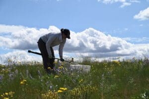
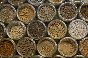
To date, nearly 1,000 soil samples and management surveys across 50 different cropping systems have been collected as a part of the state of the soils assessment. This project is being led by WSDA and WSU, with support from staff, students, conservation districts, and agricultural professionals throughout Washington.
The State of the Soils Assessment has four primary goals:
-
Assess baseline soil health in Washington
-

Understand how climate, crop type, and management impact soil health
-

Develop cost-effective ways for producers to assess their own soil health
-
Develop crop-specific decision-support tools
Customized soil health reports
To build a better understanding of soil health indicators with producers, each participating producer receives an individualized soil health report, which compares their soils from those in similar crops, regions, and across the entire project and provides a description of each soil health indicator measured. Since 2020, more than 300 participating farmers have received customized soil health reports, intended to help them access, understand, and translate their soil data into informed management decisions.
These individualized reports support soil data democracy and empower farmers to engage with their data by:
- Providing a high-level overview of soil health in agriculture.
- Synthesizing the latest research on soil health indicators with short descriptions and graphics.
- Offering context for interpreting soil health indicators (e.g., more is better, less is better, optimal range).
- Describing how to make the most of soil testing.
- Plotting the sampled fields on a map.
- Visualizing results in both table and plot formats.
- Comparing the farmer’s results with others in the same crop, region, and project.
- Providing the report in two formats:
- An interactive HTML file that can be opened in a computer browser.
- A static Microsoft Word document that can be printed or viewed on a computer.

Want to create your own customized soil health reports?
Choose the option that best fits your experience level and workflow.

View an interactive map of the State of the Soils Assessment
Click here to open the map in a new window
Resources about the State of the Soils Assessment
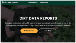
Announcing Dirt Data Reports: A No-Code Soil Health Reporting Tool
In 2023, we introduced the {soils} R package to help soil health professionals visualize, interpret, and report soil data using R and Quarto. But we know that not everyone has the…
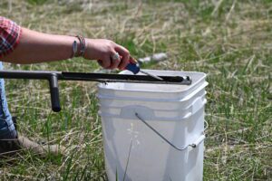
A Guide to Cleaning Soil Sampling Equipment
Read a guide to cleaning soil sampling equipment
The State of the ‘State of the Soils’
In the ongoing quest to better understand and enhance soil health across Washington, the State of the Soils Assessment is in its fifth and final year of collecting soil samples. From 2020 to 2023, nearly 1000 soil samples were collected in over 60 crop types, led by the Washington State Department of Agriculture (WSDA) and Washington State University (WSU). These samples were collected with the help of over 300 farmers and 30 conservation districts (CDs). By the end of 2024, the soil archive will include over 1200 samples and management surveys, with soil collected from every county in Washington
{soils}: An R Package for Soil Health Reporting
Understanding soil data is crucial for making informed management decisions. However, soil health outcomes are determined by many variables, and the science surrounding soil health measurements is ever evolving. This makes it difficult to present soil data in an easy-to-understand way. Enter {soils}, a new R package developed to effectively visualize and describe soil health data.